【天维网据stuff消息 Park编译】新的一周开始了,今早感觉冷飕飕的,部分地区还是有大风和潮湿天气,但接下来几天整体阳光明媚。
英文原文:After a horrible week of weather, sunny days and frosty mornings on the way
据MetService消息,接下来的几天都将晴好,但早晨会比较寒冷。
今晨,惠灵顿的人们在雨水、冰雹和寒风中苏醒,夜间最强风力在Mt Kaukau,达到120kmh,此外,机场风速达100kmh,Kelburn为100kmh,Remutaka Hill达90kmh。

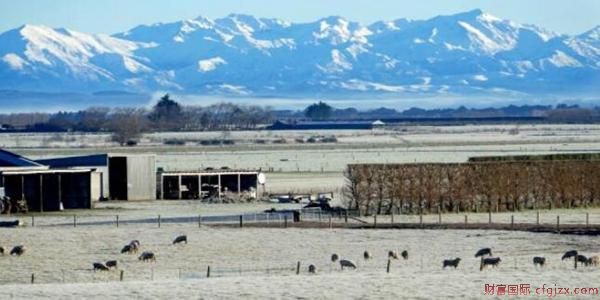
全国大部分地区受强劲南风气流影响,坎特伯雷东部地区以北有阵雨,海拔较高地区可能降雪。
到今天下午6点为止,马尔堡峡湾和惠灵顿收到强风预警;南北岛从坎特伯雷到霍克湾东海岸部分地区也设立强风观测。
到今天上午11点,Desert Road、Rimutaka Hill Road、Lewis Pass和Porters Pass有降雪预警。
虽然今日部分地区还将遭遇恶劣天气,天气预报员表示,接下来几日的趋势为晴朗,带来晴好天气的高压脊在塔斯曼海形成,白天将阳光明媚,夜间将出现霜冻和严寒。
And if you like milder temperatures, hang in there....
— NIWA Weather (@NiwaWeather) 2018年5月27日
~Chris pic.twitter.com/HznyCRJbYs
周二
北岛Taihape以北天气良好,其他地区雨势减弱,南岛整体晴朗,坎特伯雷高地多云,北部和Banks Peninsula有阵雨。
周三
北岛整体晴朗,东部地区以及惠灵顿和Taranaki有云雨天气,南岛东西海岸多云,其余地区晴朗。
周四
北岛整体晴朗,东部地区及惠灵顿有云雨天气,南岛整体晴朗。
周五
北岛整体晴朗,东部地区有云雨天气,南岛整体晴朗,但尼丁以北东海岸多云和阵雨。
Cold morning temperatures will be the big weather story over the next few days.
— NIWA Weather (@NiwaWeather) 2018年5月26日
Have a look at the forecast temperature at 7 am Mon & Tue as we zoom across the country.
Frosts will be a concern & we'll touch on that more specifically later this afternoon or evening.
~Chris pic.twitter.com/yFryYixhnG
As promised, a look at frost risk Monday & Tuesday AM. Greatest risk for a proper frost looks to be Tuesday morning due to less wind, slightly colder temps (relative to Monday AM).
— NIWA Weather (@NiwaWeather) 2018年5月27日
Watch for icy roads, especially in med-high risk areas (interior of both islands).
~Chris pic.twitter.com/K0SE8Bh782
据Niwa预测,冬季的前两个月,全国各地气温将高于北岛北部平均气温。此外,霜冻和寒流将更为普遍,6、7月份北岛北部降雨量预计偏高,将高于北岛其他地区和南岛东部和北部地区。
随着新西兰海平面气压低于正常水平,未来几个月塔斯曼海平均温度升高,可能导致降水量增加。